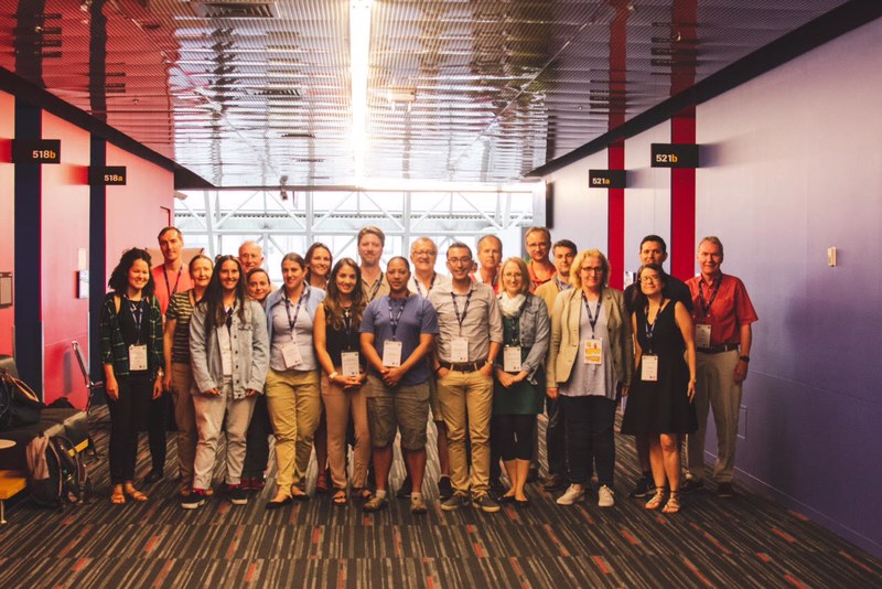
I attended great meetings discussing cutting edge scientific problems, saw a great award ceremony (Congrats again Mar and Gerard!), got feedback on my work and participated in a SAMOC workshop where the next steps of this big international program were discussed and built. I was happy to reconnect with my international network of colleagues and friends and see what are they doing. I was really glad to meet some really great scientists. So thank you Montréal, IUGG, and IAPSO for a great meeting! Next Monday I'm flying to Montréal, Canada to assist to the 27th International Union of Geodesy and Geophysics General Assembly (IUGG), which includes the Internacional Association for the Physical Science of the Oceans (IAPSO) symposia. I'm very happy of going to my first big meeting since I moved to Iceland, so I want to acknowledge the Félag íslenskra náttúrufræðinga (www.fin.is) for providing me with the funding and the Marine Research Institute (www.hafogvatn.is) for letting me go and helping me with diets for food. I will enrich from this opportunity by expanding and consolidating my international network (so I hope to see you all there!!), observing where the scientific interest lie nowadays in the physical oceanography community (hot topics), and by understanding the broad scope/impacts of my research.
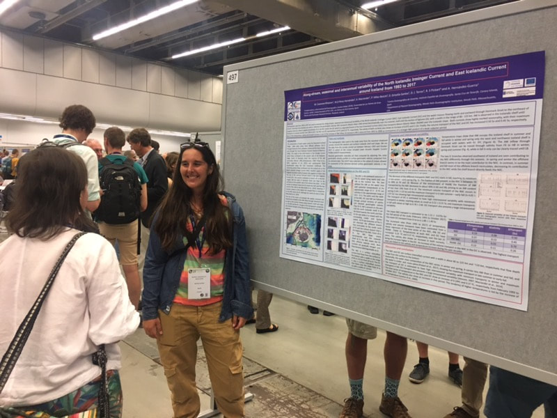
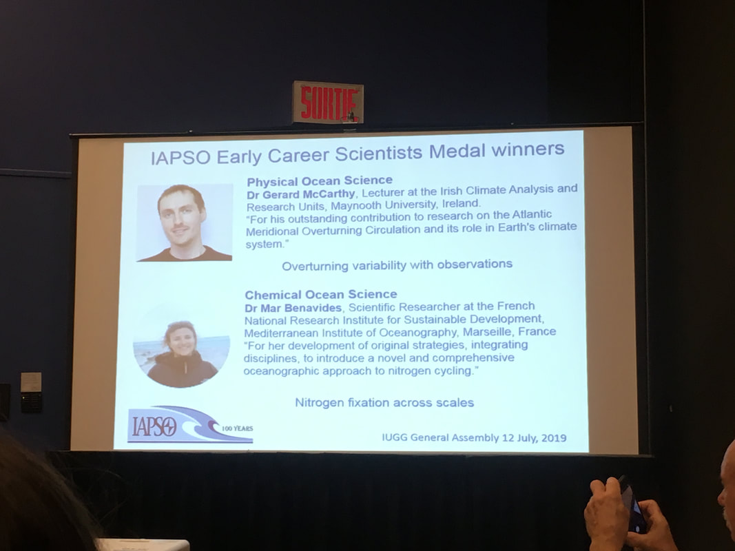
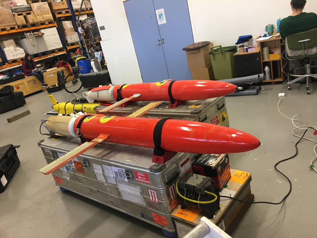
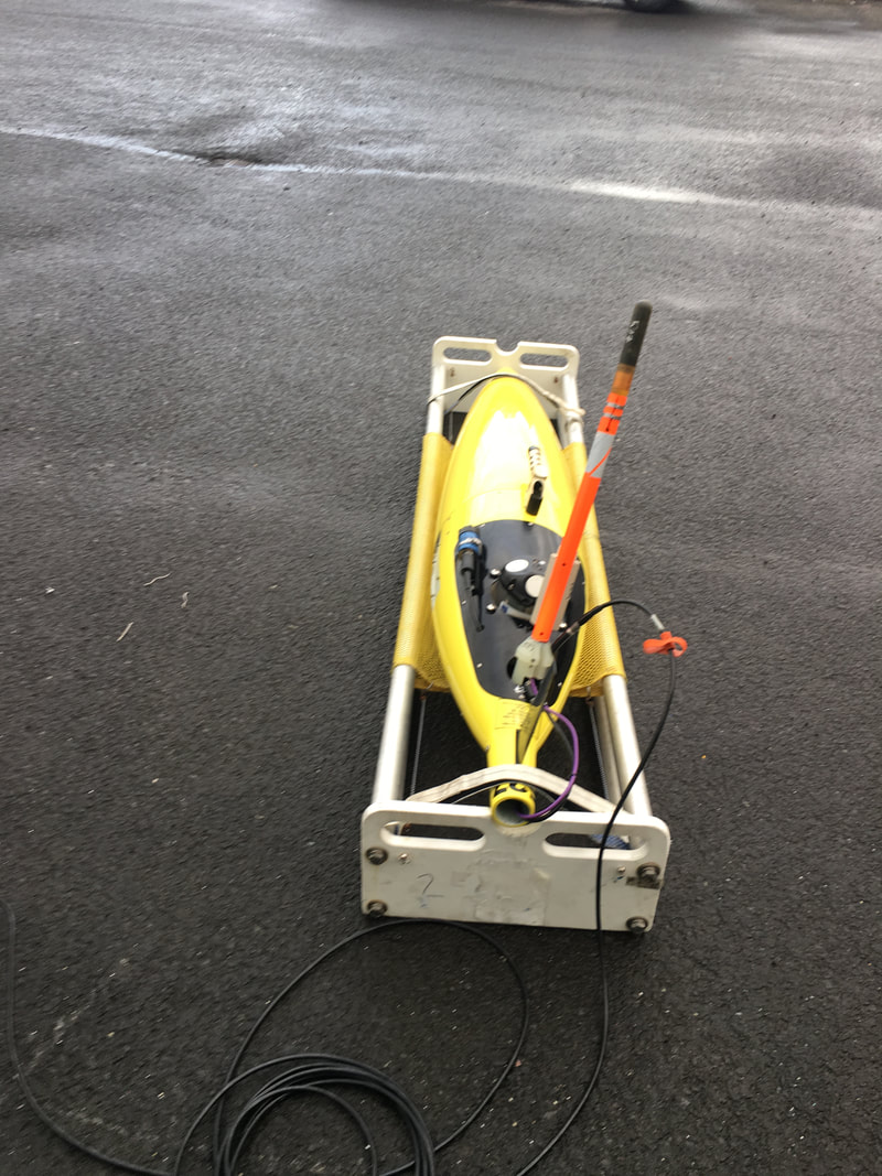
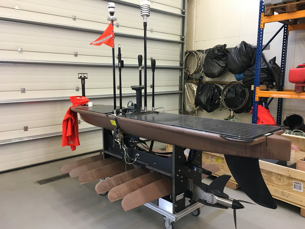
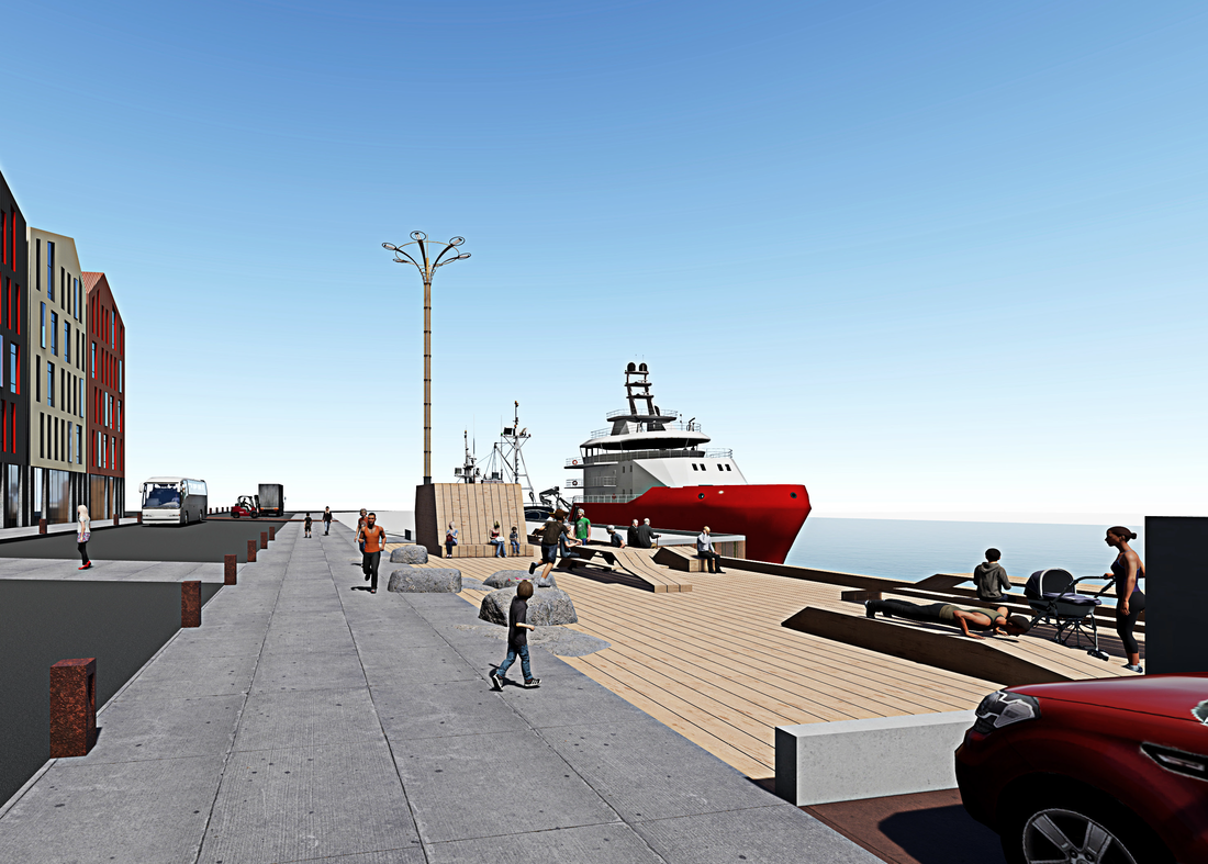
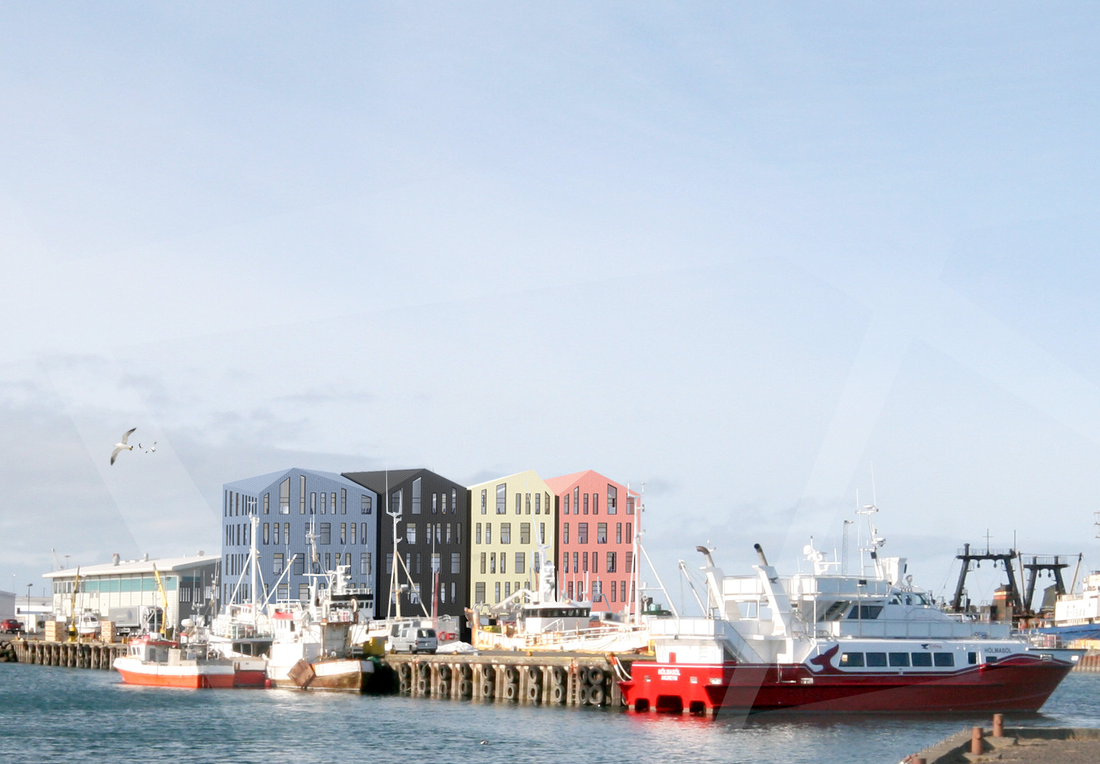
In this meeting I'll present two posters, both done in collaboration with the Instituto de Oceanografía y Cambio Global (IOCAG; http://iocag.ulpgc.es) and the Spanish Institute of Oceanography (IEO; http://www.ieo.es). Both studies use observational long-time series to describe and characterize two interesting boundary currents in the Atlantic Ocean. Come and learn about the North Icelandic Irminger Current and the Poleward intermediate current of the Lanzarote Passage!. María (my Ph.D. student) is presenting early results from a scientific research exchange. While Pedro will introduce us to his latest results from the RAPROCAN hydrographic line (1), results linked with the RAPID AMOC seasonality (2, 3). Furthermore, I'm proud to announce that two great scientists with whom I had the pleasure of having worked together on a research article (3, 4) are receiving an Early Career Award. Join me on watching them achieve an important step in their career!. ------------------ Visit our posters: - Spatial, seasonal and interannual variability of the North Icelandic Irminger Current and East Icelandic Current around Iceland from 1993-2011. María Casanova-Masjoan et al. (My Ph.D. student). P01 - Posters - General Topics in Oceanography (July 10, 15:00-16:30). - The Canary intermediate poleward undercurrent: not another poleward flow in an eastern upwelling boundary. Pedro Vélez-Belchí et al. P06 - Posters - Oceanic Boundary Current Systems(July 13, 15:00-16:30). Join me on listening to these great Early Career Scientist Medal Awardees on Friday July 12: 18:00 – 18:30 Overturning variability with observations. Gerard McCarthy (ECS Medal 2019 - Physical ocean science, Ireland) 18:30 – 19:00 Nitrogen fixation across scales. Mar Benavides (ECS Medal 2019 - Chemical ocean science, France) Con motivo de resaltar el trabajo de los jóvenes científicos en Canarias en el extranjero. Ayer, a mi compañero Dr. Borja Aguiar y a mi nos entrevistaron en la Televisión Canaria. Ambos trabajamos en corrientes marinas estudiando los efectos del cambio climático en la Antártida (Borja) e Islandia (yo). Ver en el minuto 36 (enlace en la imagen). Los últimos 20 años ha aumentado la temperatura de las aguas que rodean Islandia .............................................. With the intention of highlighting the work done by young scientists from the Canary Islands living abroad. Yesterday my colleague Dr. Borja Aguiar and I were interviewed by the Television Canaria. We both study ocean currents and climate change, while Borja focusses on Antarctica I focus on the Iceland Seas. See minute 36 (click on image). The Near Inertial Shear and Kinetic Energy in the North Atlantic experiment (NISKINe) sailed out.4/29/2019 A couple of days ago, the Icelandic weather finally provided with a good window opportunity and the NISKINe operation successfully deployed their instruments. The Icelandic Meteorological Office (IMO) confirmed that a 24 hours window was available, so we run and packed our gear and sailed west. There, we deployed a couple of assets in international waters and started to get in situ information on weather, wave, and ocean characteristics. My Icelandic collaborator from the IMO and I, we were glad to have this team and their cutting-edge technologies around and we hope them good and interesting results. 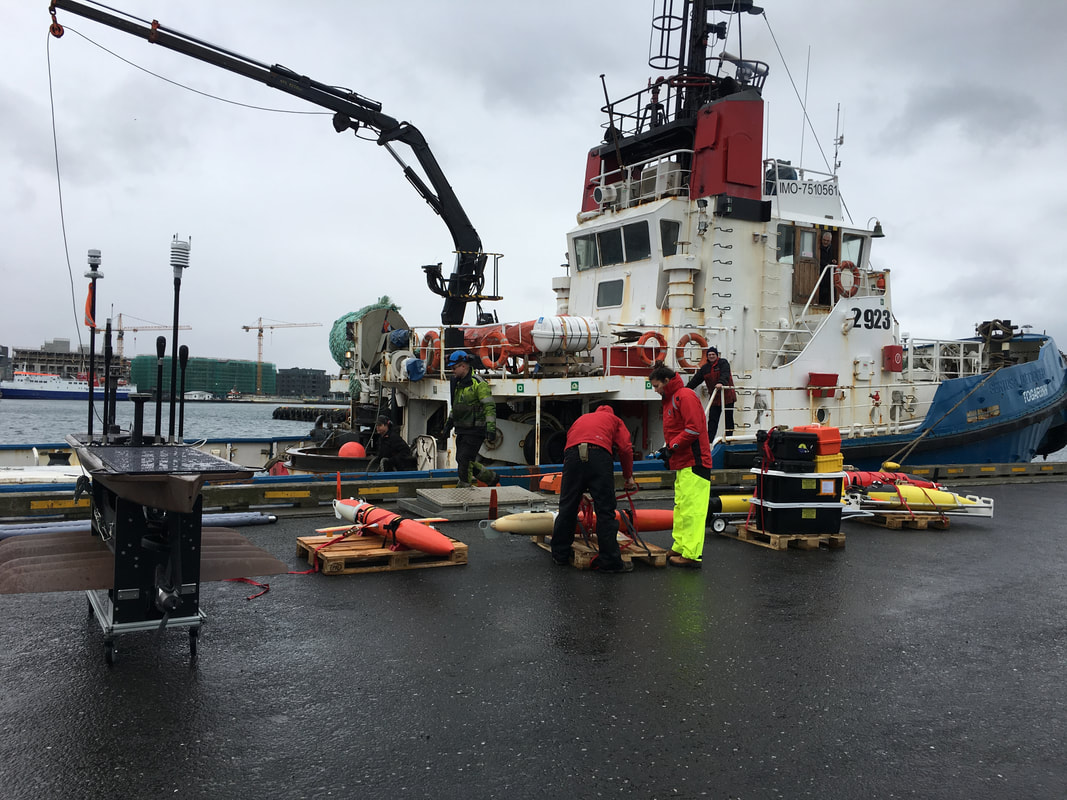 NISKINe is an Office of Naval Research (ONR) experiment bringing together observationalists, modelers, and theorists physical oceanographers to explore the near-inertial frequency dominating the upper ocean shear and substantially contribute to upper ocean turbulence. Therefore, the experiment involves collaboration between numerous research institutions from the United States and Iceland. The investigation focusses on an area southeast of Iceland were waves up to 16 meters-high have been observed. There, the upper ocean will be sampled with numerous autonomous platforms and ship measurements that will provide with very interesting results on oceanic waves and mixing. Later, modelers and theorists will contribute to the overall knowledge by helping to understand the observations and simulating the field. This past week we have been preparing some assets to be deployed in the ocean before the research vessel arrives. However, the deploying date keeps being postponed because currently the weather in Iceland is characterized by a train of storms passing by, and for example today, we are experiencing guts that go up to 25 m/s. Though is beautiful to see the power that nature has at these latitudes, We can't wait to deploy the instrumentation and start to get interesting results!! Weather can be checked here (by the way, a great colormap). My Icelandic working place, the Marine and Freshwater Research Institute will be moving out of Reykjavik late this year. We will head south, to the town of Hafnarfjörður. This town claims to be the third largest town in Iceland with the largest unbroken neighbourhood of corrugated iron-clad timberhouses. It has a good fishing harbour and sits on top of a lava field. But what is more important it is also well connected by bike paths and bus. It is expected that we will start the moving in October. One can follow the progress of the building here. But I'm also adding some pictures to show how it would look and create expectation. ----------------------------------------------------------------------------------------------------------------------------------- El instituto donde trabajo, el Marine and Freshwater Research Institute se muda de Reykjavik al pueblo de Hafnarfjörður. Un pueblo que proclama ser el tercer pueblo más grande de Islandia con la mayor cantidad de casas antiguas hechas de hierro y madera. El pueblo tiene un puerto pesquero y se asienta sobre un valle de lava. Lo más importante, es que está bien conectado con carriles bici y guaguas. Se espera que nos mudemos en Octubre. Se puede seguir el progreso de la construcción aquí. Sin embargo, subo algunas fotos para que vean como quedará y generar expectación.
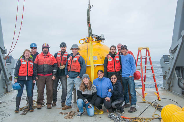
It's about the time when people start to quit their New Year Resolutions. I have the to confess I have skipped my diet (or paused it). The excuse is being on a ship is hard to follow. Guilty there, however, I have accomplished one of my New Year resolutions; publishing at least a scientific paper per year. This paper is part of my postdoctoral work, where we worked on describing the Atlantic Water (AW) Boundary Current that flows east North of Svalbard carrying warm and salty waters along the slope of the western Arctic Eurasian Basin. The paper is part of the A-TWAIN project (a collaboration between the U.S. and Norway). We used a six‐mooring array deployed at 81.7°N, 30.6°E between September 2012 and September 2013 to explore the characteristics and seasonality of the boundary current. On average the current carries 3.96 ±0.32 Sv (1 Sv=106 m3s‐1), of which 2.08±0.24 Sv are of AW. From late‐summer to early‐winter the AW was warmest and saltiest, and its eastward transport strongest, while from mid‐spring to mid‐summer the AW was coldest and freshest and its transport weakest. In this region, the layer of AW is modified via convective overturning in winter.
For more information check PUBLICATIONS above or click here. -------------------------------------- Estamos más o menos en el momento del año en que la gente empieza a dejar de lado la promesas que se hacen en Año Nuevo. Yo he de confesar que he roto la dieta que empecé. La excusa es que al embarcarme es más difícil de seguir. Sin embargo, puedo decir que ya he cumplido con una de mis promesas para este año; publicar al menos un artículo científico por año. Este artículo es parte de mi trabajo postdoctoral. En él trabajé en describir de la corriente de frontera de Agua Atlántica (AW) que fluye hacia el este al norte de Svalbard. Esta corriente transporta aguas cálidas y salinas paralela del talud continental a lo largo de la cuenca Euroasiática del Ártico. Este trabajo es parte del proyecto A-TWAIN (una colaboración entre los Estados Unidos y Noruega). Para explorar las características y la estacionalidad de la corriente entre Septiembre 2012 y Septiembre 2013, se emplearon seis fondeos localizados en 81.7°N, 30.6°E. De media, la corriente transporta 3.96 ±0.32 Sv (1 Sv=106 m3s‐1), de los cuales 2.08±0.24 Sv son de AW. Desde finales de verano hasta el comienzo del invierno, el AW se encontraba en su estado más cálido y salino del año, y su transporte fue el más intenso. Mientras, desde mediados de primavera hasta mediados de verano el AW era la más fría y menos salinia del año, presentando el menor transporte anual. En esta zona las propiedades del AW son modificadas a través de flujos convectivos verticales que tienen lugar en invierno debido al contacto con la atmósfera. Para más información vaya a la pestaña PUBLICATIONS o pique aquí. Some months ago I began to work on developing a Regional Ocean Modeling System (ROMS) 800m resolution model for the Icelandic Seas. This has led me to collaborate with people from the Norwegian Institute of Marine Research Bergen. So I’m writing this post at a very Xmas decorated airport on my way home. After many months of gathering data from many diverse sources and preparing them for the model, this week we finally started to make some runs. Though the model is not working yet, is very exiting to know that soon we could have results. This is my first attempt as a modeler and I’m very excited about these first results. There are so many things that could be done with them. One of it, is to later downscale the model to the Icelandic fiords in which aquaculture is allowed, to be able to estimate water quality. But there is so much more! Like larvae drift or the study of ocean currents dynamics. Hence, we are adding Kristinn Gudnason and Andreas Macradnder to the IceROMS team. Let’s work step by step and fingers crossed!  (En español debajo de las fotos) RAPROCAN0208 was my first oceanographic cruise. Incredibly it’s been ten years since that...I was studying my fourth year of Marine Science in the University of Las Palmas de Gran Canaria, and the next year we had to choose between the three branches our bachelor had: oceanography, coastal management or living resources. I was having doubts, but my friend Ana was very certain she wanted to be an oceanographer so she convinced me to volunteer on a ten days cruise organized by our profesor Alonso Hernández Guerra together with Pedro Vélez Belchí from the Spanish institute of Oceanography. Due to a storm, the storage became inaccessible, and we didn’t had a proper rosette. So part of my duties where to download the data and change the batteries of a CTD running in shelfcontent mode. The research vessel was the Cornide de Saavedra, now retired. It was a life changing experience, full of good memories. At the end I stayed in oceanography while my friend (after getting sea sick) changed to study living resources. After that I did several RAPROCAN cruises, every time with new students coming in to get their first experiences at sea. RAPROCAN started in 2003 with the objective of monitoring the Canary Current and maintaining the EBC mooring and the ESTOC station. Initially consisted in a hydrographic section with biogeochemistry measurements carried out north of the Canary Archipelago. But RAPROCAN evolves and the original hydrographic line became a box for inverse modeling, we got bird watchers, we started to deploy Argo floats, later even deep Argo floats, then we explored the flow across the Lanzarote Passage and we added altimeter and our own wind model. RAPROCAN has been focussing in Canary basin while, without noticing it, It has also became a path for many marine scientists on the Canary Islands. RAPROCAN1018 is out there, on board the RV Ángeles Albariño still working on its people and ocean. They deployed an Argo float yesterday and they are facing a storm with proper lightnings. My thought goes to them, so we can keep on cultivating young enthusiastic researchers on the Canary Islands. ~~~~~~~~ Want to follow them?@ArgoEsp on Twitter Some of the RAPROCAN publications can be found on this site (either on publications or in projects) or in the IOCAG webpage. RAPROCAN (Radial Profunda de Canarias)RAPROCAN0208 fue mi primera campaña oceanográfica. Increíblemente han pasado diez años desde entonces..... Estaba cursando el cuarto año de la Licenciatura en Ciencias del Mar en la Universidad de Las Palmas de Gran Canaria, y el próximo año habíamos de elegir entre las tres ramas de la carrera; oceanografía, gestión costera o recursos vivos. Yo tenía dudas pero mi amiga Ana tenía claro que ella quería ser oceanógrafa, así que me convenció para ir de voluntarias en una campaña organizada por nuestro profesor Alonso Hernández Guerra conjuntamente con Pedro Vélez Belchí del Instituto Español de Oceanografía. Debido a una tormenta, no se pudo acceder al almacén y no dispusimos de roseta. Así que parte de mis tareas en la campaña consistieron en descargar los datos y cambiar la batería del CTD en autocontenido. El buque oceanográfico fue, el ya retirado, Cornide de Saavedra. Fue una experiencia única, de esas que te cambian la vida, y llena de buenas memorias. Al final de la campaña yo me quedé en oceanografía y mi amiga Ana cambió a estudiar recursos vivos (ya que mareaba). Después hice muchas RAPROCANes más y en cada una venían nuevos estudiantes a tener su primera experiencia como oceanógrafos.
RAPROCAN es un proyecto que comenzó en 2003 con el objetivo de monotorizar la Corriente de Canarias, mantener el fondeo EBC y medir la estación ESTOC. Inicialmente consistía en una sección hidrográfica acompañada de medidas biogeoquímicas, realizada al norte del archipiélago Canario. Pero RAPROCAN evoluciona y la línea original se convirtió en una caja para modelo inverso, empezamos a lanzar perfiladores Argo y Argo profundos, a tener oteadores de aves, a explorar el pasaje de Lanzarote, añadimos medidas de satélite y hasta creamos nuestro propio modelo de vientos. Mientras la RAPROCAN se ha centrado en estudiar la Corriente de Canarias, sin notarlo, se ha convertido también en un referente paso para muchos cientifícos marinos de las Islas Canarias. Hoy la RAPROCAN1018 está en curso, a bordo del RV Ángeles Albariño donde sigue trabajando en su gente y su océano. Ayer lanzaron un perfilador Argo y hoy hacían frente a una tormenta con rayos. Mi pensamiento hoy va para ellos, de manera que sigamos cultivando jóvenes científicos entusiastas en las islas Canarias. ~~~~~~~~ ¿Quieres seguirles?@ArgoEsp en Twitter Algunos de los resultados publicados a raíz de RAPROCAN pueden verse en la sección de publicaciones y proyectos de esta web, otros se hayan en la web del IOCAG.
 |
Archives
April 2024
|
 RSS Feed
